

Understanding Public Roads
Public Roads: Complete Guide
Understanding road elements, types, intersections and traffic rules for safer driving
Public Road
A public road is a land communication route allocated to public traffic, which allows the free circulation of vehicles, pedestrians and animals with the restrictions imposed by the Highway Code.
We should have good knowledge of all elements that make up the public road to be able to circulate safely and know how to correctly answer exam questions.
The main elements that constitute the public road are:
- Carriageway — Part of the public road especially destined for the traffic of vehicles;
- Traffic lane — Longitudinal zone of the carriageway destined for the circulation of a single line of vehicles;
- Carriageway axis — Longitudinal line, materialised or not, that divides a carriageway into two parts, each affected by a direction of traffic;
- Hard shoulder — Surface of the public road not especially destined for the traffic of vehicles and that borders the carriageway;
- Road markings:
- Kerbs — Used to delimit the carriageway more visibly and can be used along the edges of the same;
- Continuous line — Means for the driver the prohibition to tread or cross it and, as well, the duty to transit to its right when it makes separation of traffic directions;
- Broken line — Means for the driver the duty to remain in the traffic lane that it delimits, only being able to be trodden or crossed to perform manoeuvres;
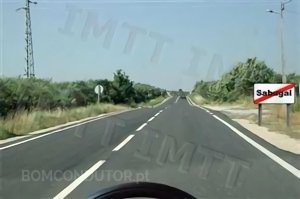
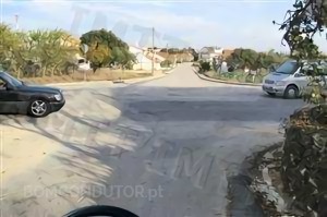
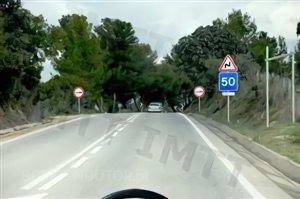
The following image illustrates a public road and the most important elements of it:
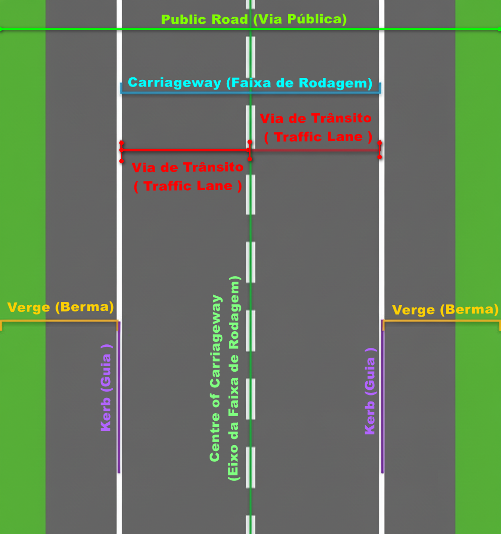
Carriageway with two traffic lanes, one in each direction of traffic
In this public road there is a carriageway with two traffic lanes, one in each direction of traffic.
Carriageway
The term "carriageway" will appear frequently in exam questions. It is on the carriageway that the circulation of vehicles occurs and where the majority of manoeuvres are performed.
The carriageway is composed of one or more traffic lanes, when it has two directions of traffic there is a carriageway axis that divides the directions of traffic. It is delimited by the kerbs that separate the carriageway from the hard shoulders.
As a general rule, in the majority of public roads, there is only one carriageway however there are exceptions, in the case of motorways and roads reserved for automobiles and motorcycles there are two carriageways as is indicated in their legal definition:
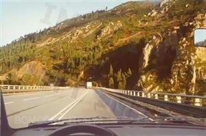
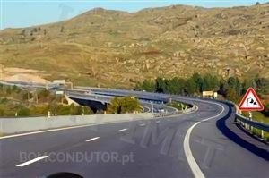
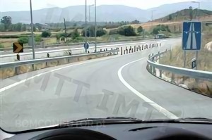
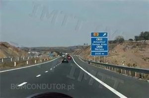
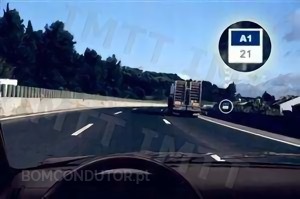
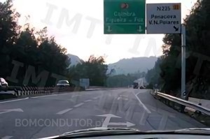
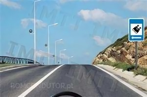
Motorway — Public road destined to fast traffic, with physical separation of carriageways, without level crossings nor access to marginal properties, with conditioned accesses and signalled as such.
We can see an example of these roads in the following image:
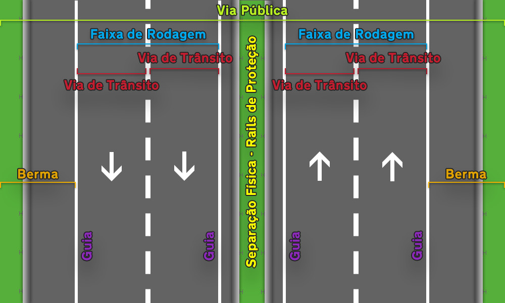
Motorway with two separate carriageways
As can be seen by the image, there are two carriageways, with traffic lanes, kerbs, etc. Attention that in each carriageway the circulation of vehicles is only done in one direction and in this way there is no carriageway axis.
Carriageway Axis
The carriageway axis separates the directions of traffic, on the left side of the carriageway axis the circulation of vehicles is done only in one direction (opposite direction) and on the right side also only in one direction, contrary to the left.
The carriageway axis is not always in the middle of the carriageway, for example if there are three traffic lanes the carriageway axis is the following:
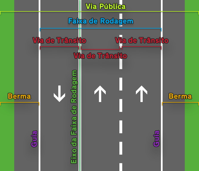
Carriageway with three traffic lanes and carriageway axis
Types of Roads and Itineraries
The highway code makes distinction between some types of public road in order to be able to have different rules for each type, such as speed limits or the possibility of stop and parking on the roads. There are the following types of road:
- Coexistence zones (inside built-up areas)
- Road inside built-up area
- Road outside built-up area
- Roads reserved to automobiles and motorcycles
- Motorways
In addition to the types of road there are the itineraries which are not a type of road, these itineraries can pass through several different types of road and are:
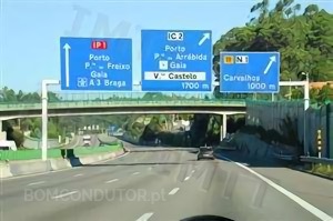
- Main itineraries (IP) - The main itineraries are the communication routes of greatest national interest, serve as base of support to the whole national road network, and assure the connection between the urban centres with supra district influence and of these with the main ports, airports and borders.
- Complementary itineraries (IC) - The complementary itineraries are the routes that, in the context of the national road plan, establish the connections of greatest regional interest, as well as the main surrounding and access routes in the metropolitan areas of Lisbon and Porto.
- National Roads (EN)
- Regional Roads (ER)
Distinguishing Types of Road
Frequently we are questioned how to distinguish the different types of road by the images of the exam questions, here are some examples and tips:
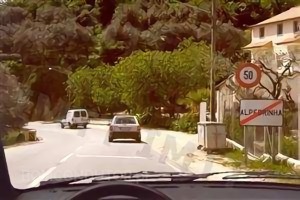
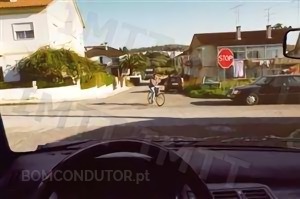
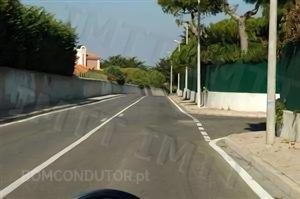
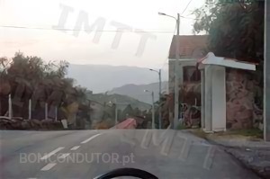
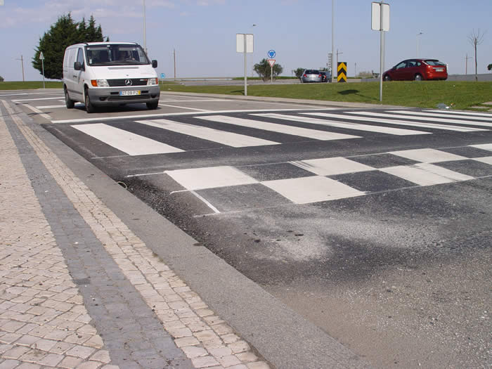
Roads inside built-up area
Built-up area - zone with buildings and whose limits are signalled with the regulatory signs;
We should consider that we are inside a built-up area whenever we are before the sign N1A - Beginning of built-up area:

N1A - Beginning of built-up area sign
In the absence of this sign in the image we can try to identify the place as inside built-up area depending on some characteristics of the roads.
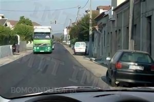
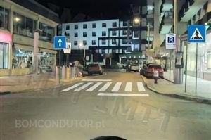
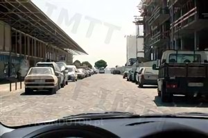
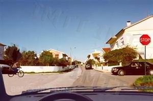
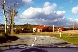
Generally in the images, the roads inside built-up area are surrounded by buildings, pavements and sometimes pedestrians.
These are examples of some roads inside built-up area:

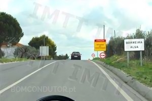
In the following images although the place does not seem inside built-up area we are before the sign N1A - Beginning of built-up area and in this way we should consider that after passing the sign we are inside a built-up area:

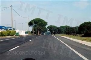
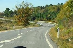
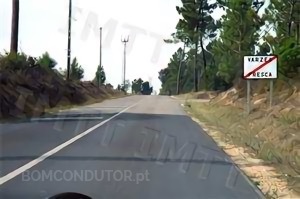
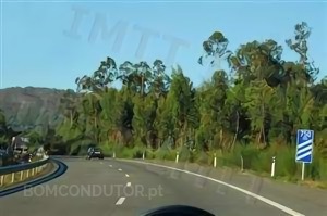
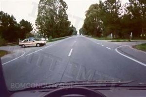
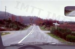
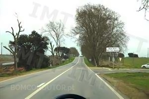
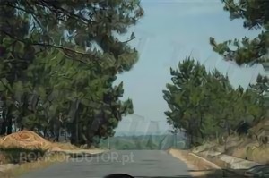
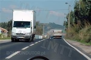
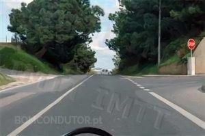
Roads outside built-up area
We should consider that we are outside built-up area whenever we are before the sign N2A - End of built-up area:

N2A - End of built-up area sign
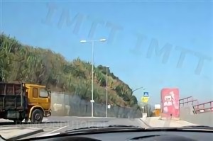
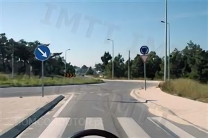
In the absence of this sign in the image we can try to identify the place as outside built-up area depending on some characteristics of the roads.
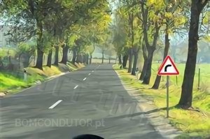
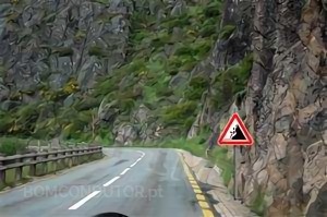
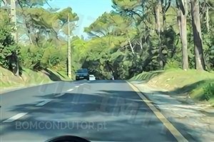
Generally in the images, these roads have very few or none of: pavements, pedestrians, marginal buildings to the road, parking places and frequently are situated in places in the middle of nature with vegetation and trees, it is also common to have hard shoulders.
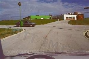
Here are some examples:
In the following images the sign N2A - End of built-up area is present indicating thus that we are outside a built-up area:
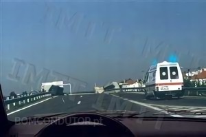
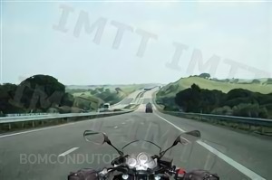
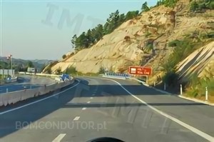
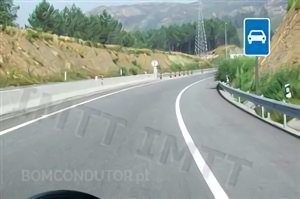
Motorways and Roads reserved to automobiles and motorcycles (VRAM)
The physical characteristics of these two types of road are the same:
Motorway - public road destined to fast traffic, with physical separation of carriageways, without level crossings nor access to marginal properties, with conditioned accesses and signalled as such;
Road reserved to automobiles and motorcycles - public road where the norms that discipline the traffic in motorway are in force and signalled as such;
These roads have the carriageways separated, as a general rule by protection rails or cement barriers:
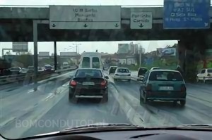
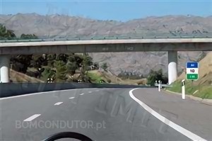
Do not have level crossings, which means that we cannot find a crossing with another road where we have luminous signalling or give way signs for example, the roads that cross the motorways or VRAM pass over or under these and are known as overpasses or underpasses:
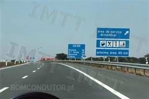
These roads do not have access to marginal properties, have conditioned accesses and signalled as such (H24 - Motorway, H25 - Road reserved to automobiles and motorcycles), that is, we only have access to these roads by the access ramps that as a general rule are composed by acceleration or deceleration lanes:
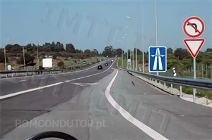
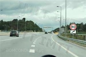
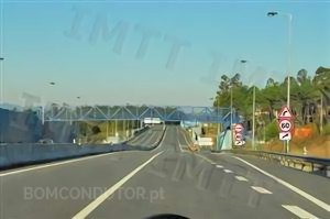
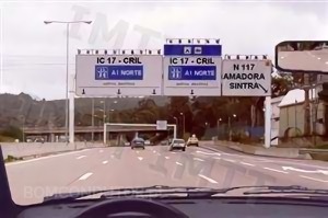
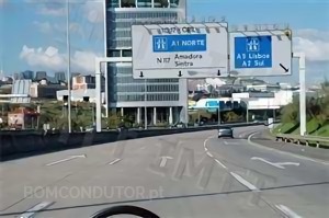
How to distinguish Motorways from Roads reserved to automobiles and motorcycles
To differentiate these two types of road we have to analyse the signalling present in the image, if the sign H24 - Motorway or the H25 - Road reserved to automobiles and motorcycles is present we know the type of road. When these signs are not present we resort to other signs:
Article 18.º — Colours
4 — The signs of selection and of allocation of lanes, of pre-signalling, of confirmation and complementary, with exception of the refuges and beacons, must have background colour corresponding to the road network in which they are placed according to table XX, in annex, being understood, for that effect, that:
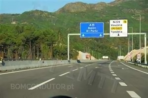
a) To the fundamental network, constituted by main itineraries, corresponds the colour green;
b) To the motorways, whatever the network in which they are integrated, corresponds the colour blue;
c) To the remaining public roads corresponds the colour white.
The signs of selection and of allocation of lanes, of pre-signalling, of confirmation and complementary must have blue colour when they are placed in motorway and colour green or white if it is VRAM or remaining roads, thus we can distinguish the motorways from the roads reserved to automobiles and motorcycles by the colour of these signs.
Here are some examples of signalling in the motorway:
Examples of signalling in road reserved to automobiles and motorcycles:
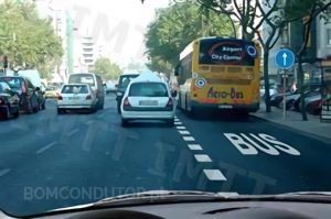
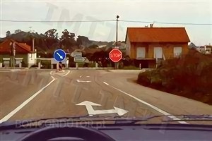
Intersections
Crossroads
Crossroad — Zone of intersection of public roads at the same level.
A crossroad is the intersection or crossing of public roads, as a general rule two, when one road crosses the other. It is common for a crossroad to have the format of a plus sign or a multiplication sign (+ or x).
Here are some examples of crossroads in the questions:
Junctions
Junction — Zone of junction or bifurcation of public roads.
A junction is the junction or a bifurcation of two public roads. It is common for a junction to have the format of the letter "T" or the letter "Y".
Here are some examples of junctions in the questions:
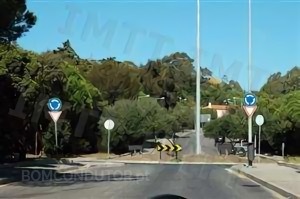
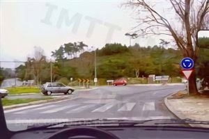
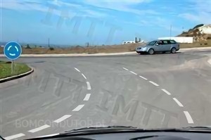
Roundabouts
Roundabout — Square formed by crossroad or junction where the traffic is processed in rotary direction and signalled as such.
The roundabouts help in the flow of traffic in places where a high number of vehicles circulate, as a general rule they are places with a format of the letter "O" or of the symbol.
Here are some examples of roundabouts in the questions:
We advise the consultation of our summary "Circulation in roundabouts" to know how to circulate in a roundabout.
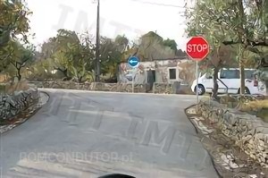
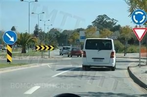
Square
The difference between a square and a roundabout is the signalling, the format of the road is the same because it is a place where the traffic is processed in rotary direction. If the obligation sign D4 - Roundabout is present we should consider that it is a roundabout and who circulates in it has priority, if the sign does not exist we should consider that we are only in a square and where the general rule of priority to the right is in force.
Here is a clear example of the difference between square and roundabout:

We clarify however that the sign D4 - Roundabout should be placed at the entrance of the roundabout and not in the central plaque as in the first image. The IMT placed the sign in the central plaque to be possible to differentiate the place of a square as can be seen in the second image.
Deformations of the Road
Road Humps
The road humps are deformations of the road that as a general rule break the visibility, when it is mentioned in the questions, in the law or in our comments "road hump" we refer to the following road humps:


We remind that as a general rule these road humps are not identified with the danger sign A2A - Road hump, the fact that the danger sign is not present does not mean that it is not a road hump, as can be seen by the images above none of the road humps is identified with the danger sign. As a general rule the danger sign is only used in the speed reducing road humps or in another type of similar deformation.
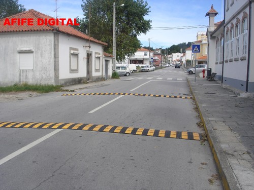
One should not confuse the previous road humps with the speed reducing road humps:
Speed Reducing Road Humps
The speed reducing road humps are used to force the drivers to practice a more reduced speed in certain places.
Here are some examples of these road humps:
Sources
1 — Principles of Traffic Signalling and Circulation Regimes (Page 14)